


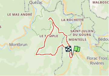
Belvédère du Single/ Condamine

tyntyn
User

Length
15.1 km

Max alt
1068 m

Uphill gradient
347 m
Km-Effort
19.7 km

Min alt
883 m

Downhill gradient
347 m
Boucle
Yes
Creation date :
2025-01-31 12:15:44.001
Updated on :
2025-01-31 16:46:31.514
4h30
Difficulty : Medium

FREE GPS app for hiking
 SityTrail
IGN / Geographical institutes
SityTrail Plus
The world is yours!
About
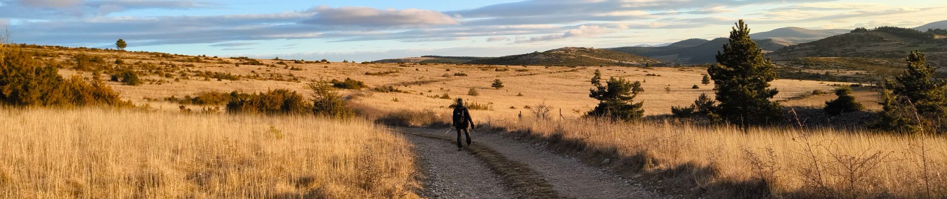
Trail Walking of 15.1 km to be discovered at Occitania, Lozère, Florac Trois Rivières. This trail is proposed by tyntyn.
Photos


Positioning
Country:
France
Region :
Occitania
Department/Province :
Lozère
Municipality :
Florac Trois Rivières
Location:
Florac
Start:(Dec)
Start:(UTM)
545167 ; 4908454 (31T) N.
Comments
belle balade sous le soleil mais avec du vent, super panorama